![[WV 44]](transpo/wv44.png)
![[WV 20]](transpo/wv20.png)
![[WV 20]](transpo/wv20a.png)
![[WV 20]](transpo/wv20smap.png)
| Highway | Start | Terminus | Length (km) |
|---|---|---|---|
| WV 20 | Mercer County line south of Pipestem | Fayette County line northwest of Elton | 58 |
| WV 44 (historical) | Mercer County line south of Pipestem | Fayette County line northwest of Elton | 57 |
Route 20 is the longest West Virginia state primary highway, and second to US 119 as the longest highway of any kind in the state.
In Summers County, WV 20 functions as an important conduit of tourist and visitor traffic, linking the city of Hinton to I-64 to the north, Princeton and Mercer County to the south, and both of the county's state parks. The highway runs parallel to the New River, and much of its course is very scenic. Living in the area, I always associated Route 20 in Summers County as a stepping stone to recreational excitement, and every trip down the road was a thrill!
Northbound traffic on 20 enters Summers County alongside Knob Ridge, home to Pipestem State Park. The road straddles the Pipestem Creek Valley, passing Pipestem Falls and descending over 270 metres in elevation to the New River, home of Bluestone Lake, a 2000-acre reservoir formed by the Bluestone Dam in the late 1940s. The road also passes the access point of Bluestone State Park, linked to Pipestem by a connecting hiking path and the Bluestone National Scenic River.
WV 20 hugs the west bank of the New River after Bluestone, joins WV 3 for a short concurrency, and crosses over at Hinton, Summer's county seat and sole incorporated municipality. Northbound and southbound traffic are separated through the Hinton street grid. The highway emerges on Hinton's north side, running parallel to the New River and the C&O Railroad.
Near Sandstone Falls, the highway passes through a treacherous inland segment rife with inclines and curves, including a 180-degree hairpin turn. Talk of bypassing this segment has brewed since the 1990s, and road improvements have been made on the opposite side of the river in anticipation of a future bridge crossing.
The rest of the highway is lightly-trafficked and comparably easy-going. After reaching I-64 at Lick Creek, WV 20 bears east and runs alongside the expressway to the interestingly-named community of Elton. The road then takes a northwestern tack, leaving Summers County just shy of Meadow Bridge.
A road approximate to WV 20's course along Lick Creek and the New River was in place on the Lloyd map of the mid-nineteenth century. Hinton was founded in 1873, and the highway's early routing south of the Bluestone River appeared on topographic maps by the following decade. The gaps between were bridged...literally...when a truss span between Hinton and the west-side community of Brooklin opened in 1907. A bridge over the Bluestone River at True was also added by the early 1920s, bringing into place all the ingredients for a new through highway.
![[WV 20 map]](transpo/wv20x-22src2.jpg)
![[WV 44 map]](transpo/wv44x-33clarksburg.jpg)
![[WV 20 map]](transpo/wv20x-46src.png)
(WV State Road Commission, 1922; Clarksburg Publishing Co., 1933; SRC, 1946)
In 1922, West Virginia's numbered highway system debuted. WV 20 was on the map, with Summers County as the midpoint of its route between Princeton and Rainelle. However, it didn't stay consistent: By 1932, the State Road Commission had inexplicably renumbered the highway as WV 44. This carried forth when West Virginia's county highway system was established in the mid-1930s, resulting in a plethora of "44"-prefixed fractional roads that remain along the route to this day.
In a wave of route consolidation, WV 44 was extended and combined end-to-end with other north-south roads cutting across the state, including a new incarnation of WV 20. In 1941, the highway was re-renumbered as [drum roll]...WV 20! All that, just to be right back where they started again.
A full list of known adjustments follows:
![[WV 20]](transpo/wv20sy.png)
![[WV 44]](transpo/wv44x-33clarksburg2.jpg)
![[WV 44]](transpo/wv44x-35src.png)
![[WV 20]](transpo/wv20x-46src2.png)
![[WV 20]](transpo/wv20x-46src3.png)
![[WV 20]](transpo/wv20x-c75wvdh.png)
![[WV 20]](transpo/wv20x-04wvdot.png)
WV 20 interfaces with I-64 at both Sandstone (Exit 139) and Green Sulphur Springs (Exit 143). Since the 9 kilometres of WV 20 in between are redundant, it's perplexing why they continue to be maintained as a primary highway.
All photos by the author, 2013 (except as otherwise noted):
![[WV 20 photo]](transpo/wv20-pipestem13.jpg)
A: Shortly beyond Pipestem State Park in southern Summers County lies the community of Pipestem itself...a speck on the map with a post office, bound by geography. Note the ornamentation on the bridge, which is typical of state-commissioned road structures of the 1930s and 1940s.
![[WV 20 photo]](transpo/wv20-pipestem13b.jpg)
![[WV 20 photo]](transpo/wv20-pipestem13a.jpg)
Pipestem is also home to Pipestem Creek and Pipestem Falls, where the flow of the stream takes a nine-metre drop. The falls are marked on WV 20 by a historical marker and small shoulder turn-out, and are easily overlooked.
![[WV 20 photo]](transpo/wv20-lillybridge-postcard.jpg)
B: The creek and highway run in parallel for 15 kilometres before reaching the Bluestone River at Bluestone Lake, an artificial reservoir and boating mecca. For years, the highway was carried over the lake by the Lilly Bridge, a high cantilevered truss. Frighteningly, the bridge actually collapsed while under construction in 1949, resulting in 5 workers' deaths. After a delay and mourning, the bridge ultimately opened in 1950.
This is a colour photo postcard of the bridge in its initial silver livery, probably from the 1950s. The original alignment of WV 20, partially inundated by the lake, is visible as a sandbar at left.
![[WV 20 photo]](transpo/wv20-lillybridge13.jpg)
Driving over the Lilly Bridge in a rainstorm in 2013, for what turned out to be the last time. In 2015, this bridge was replaced by a new structure and dismantled.
![[WV 20 photo]](transpo/wv20-bluestonedam87.jpg)
C: The Bluestone Dam was built in tandem with the Lilly Bridge, and was intended to provide flood control to the downstream Kanawha River Valley (which has happened on multiple occasions), and hydroelectric power (which ended up not happening at all). Construction began in 1942 and was completed in 1949 apart from crest gates, which were added in 1952. (Family photo, 1987.)
I went on two tours of this dam in the early 1990s, and it was a fascinating experience...not least in the lower control room, which still had old equipment and a time capsule to be opened at a future date! Alas, 9/11 happened; the dam got immediately bogged down in "security" theatre, and it's a question mark whether anyone is ever still allowed to see it up close.
![[WV 20 photo]](transpo/wv20-hinton13.jpg)
D: A disused Exxon station north of the dam, where WV 20 and WV 3 join forces for a mile-long (1.7 km) concurrency. I wonder if the contents of the underground tanks are now in the New River? :-P
![[WV 20 photo]](transpo/wv20-hinton13a.jpg)
What would the New River Valley be without a few kitschy tourist traps like this? I actually went on a tour of this "museum" in the spring of 1991: All I remember was a musty downstairs room filled with dead stuffed animals, a framed display of arrowheads on the wall, and an "EXIT" sign on the door that I felt most drawn to.
By 2013, the property was standing forlorn and the front of the building looked like it was about to crash to the pavement below. The same is true today, although it's managed to look even more frightening.
![[WV 20 photo]](transpo/wv20-hinton-postcard.jpg)
E: WV 20 originally crossed the New River on the Hinton Toll Bridge (a.k.a. New River Bridge or County Bridge), a spindly truss structure built in 1907. The highway was routed away from this bridge by 1955, crossing over at the much newer Bellepoint Bridge upstream and being routed to downtown Hinton on the east bank of the New River. The Toll Bridge was replaced in 1975, enabling WV 20 to revert to its original routing, and subsequently demolished.
This is a colour postcard photo of unknown era; probably the 1950s. The white structure in the distance is actually a coaling tower for the C&O Railroad, which passed under the bridge on the opposite shore.
![[WV 20 photo]](transpo/wv20-hinton64yearbook.jpg)
Route markers for WV 20 and Alternate 3 in Hinton, facing traffic off the bridge at 2nd Avenue in either 1963 or 1964. Signs below give directions and distances to Rainelle, Peterstown, and Lewisburg...although you may have to take my word for that! At the time, WV 20 took a southerly turn away from Temple Street at this intersection, following the east bank of the New River to avoid overloading the Hinton Toll Bridge. (Hinton High School yearbook, 1964.)
![[WV 20 photo]](transpo/wv20-hinton13b.jpg)
![[WV 20 photo]](transpo/wv20-hinton13g.jpg)
Downtown Hinton may be small, but it has lots of charm. Here are three buildings that face traffic on 20: The historic National Bank of Summers of Hinton, the Hinton Daily News, and the Hinton Taxi Company (with a ghost sign still reading "Phone 200"). None of these still house the business with which they are identified...but the bank building is now home to a public library, a superior trade-off.
WV 20 undergoes a one-way split for the fifteen blocks aft of this intersection, with northbound traffic funneled along Temple Street and southbound traffic instead following Summers Street and 2nd Avenue.
![[WV 20 photo]](transpo/wv20-hinton71yearbook.jpg)
F: Hinton High School on Temple Street, from a 1971 yearbook picture. Note the "20" route marker in front.
Hinton High operated from this site until 1995, when it was replaced by a consolidated high school on Hinton's outskirts. The old building continued to house a middle school until 2020, then it succumbed to closure...a symptom of depopulation and the educational disinvestment killing the region.
![[WV 20 photo]](transpo/wv20-hinton13d.jpg)
While passing through Hinton in 2013, I was shocked to see that an interconnected tenement building spanning an entire city block had completely burned down, leaving 11 families without homes. Worse yet, arson was blamed.
This ruined building was later demolished...just in time for the house across the street to also meet a fiery demise.
![[WV 20 photo]](transpo/wv20-hinton13c.jpg)
G: Ah, the final photo. The Riverview School is located at the far end of Hinton's street grid, where north- and southbound traffic once again come together. It still stands...not as a font of education (it closed eons ago), but as a historic landmark and a brick wall for the city to lash tourism billboards to.
![[WV 44]](transpo/wv44sfract.png)
Route 20 was signed as Route 44 at the time the fractional road system was established in the 1930s, and the oldest spur roads thus bear "44" numerators as a shadowy, ghost-like reminder of the former road. CR 44/1 through CR 44/14 were numbered off southly from Fayette County to Mercer County as part of the original fractional number allocation in 1933, with higher-numbered roads being later additions.
| Road | Names | Start | Terminus | Length (km) | Notes |
|---|---|---|---|---|---|
| 44/1 | Coon Creek Rd. | CR 44/21 (former WV 44) near Meadow Bridge | dead end | insignificant | Original 1930s assignment. Originally through to CR 1. |
| 44/2 (old) | Patterson Mountain Rd. | CR 44/21 (former WV 44) near Meadow Bridge | Fayette County line, continues as CR 44/2. | insignificant | Original 1930s assignment. Probable former alignment of WV 44. Now part of CR 44/21. |
| 44/3 | Duncan Branch Rd. | CR 4, Green Sulphur Springs | dead end | 11 | Original 1930s assignment. Did not actually touch WV 44. |
| 44/4 | Cooper Hollow Rd., Chestnut Mountain Rd. | WV 20 (former 44) near Sandstone | CR 7 south of Ramp | 9 | Original 1930s assignment. Central segment impassable. |
| 44/5 | Brier Ridge Rd., Avian Center Rd., Brooks Mountain Rd. | WV 20 (former 44) near Sandstone | WV 20, Brooks | 6 | Original 1930s assignment. Former alignment of WV 44. North segment impassable. |
| 44/6 | Raleigh St., Tug Creek Mountain Rd. | Temple St (WV 20 & former 44), Hinton | CR 7 near Crossroads | 10 | Original 1930s assignment. Westernmost block impassable. |
| 44/7 | Leatherwood Rd. | WV 20 (former 44) near Bluestone Dam | CR 3/4, Nimitz | 8 | Original 1930s assignment. East end realigned by 1949. |
| 44/8 (old) | (unknown name) | WV 20 (former 44), mouth of Bluestone River | dead end | 7 | Original 1930s assignment. Vacated by 1949 and inundated by Bluestone Lake. |
| 44/8 | Frank Brown Rd. | CR 44/6 east of Hinton | dead end | 3 | |
| 44/9 (old) | (unknown name) | WV 20 (former 44), mouth of Bluestone River | Former CR 28, Warford (now a park road within Bluestone Lake WMA) | 10 | Original 1930s assignment. Vacated by 1949 and inundated by Bluestone Lake. |
| 44/10 | River Ridge Rd. | WV 20 (former 44) near mouth of Bluestone River | CR 44/11 near Farley | 12 | Original 1930s assignment. North segment impassable. |
| 44/11 | Warford Rd., Gravelly Point Rd. | WV 20 (former 44), Pipestem | Former CR 26, Warford (now a park road within Bluestone Lake WMA) | 7 | Original 1930s assignment. |
| 44/12 | Cooks Chapel Rd., Broadway Rd. | WV 20 (former 44) south of Pipestem | CR 44/11, Farley | 4 | Original 1930s assignment. |
| 44/13 | Knob Ridge Rd. | WV 20 (former 44) south of Pipestem | dead end (originally through to Mercer County CR 4/2) | insignificant | Original 1930s assignment. Originally 5 km long. West portion now impassable to traffic; forms portions of Lake View Trail and a park road in Pipestem State Park. |
| 44/14 | Pipestem Knob Rd., Rocky Mount Rd. | CR 26 south of Pipestem (originally connected to former WV 44) | CR 44/12 near Pipestem | 3 | Original 1930s assignment. |
| 44/15 | Patterson Creek Rd. | CR 44/3 near Greenbrier County line | Greenbrier County line, continues as CR 27/2. | insignificant | |
| 44/16 | Lane School Rd. | WV 20 (former 44) north of Elton | dead end | insignificant | |
| 44/17 | N. Mullens Rd. | WV 20 (former 44), Brooks | dead end | insignificant | |
| 44/18 | Rich Monte Farm Rd. | WV 20 (former 44) north of Elton | dead end | 2 | Originally routed along former alignments of WV 44 and CR 44/2 to county line; later adjusted east. |
| 44/19 | Lester Neely Rd. | CR 44/20 north of Bluestone State Park | dead end | insignificant | South end realigned after 1949. |
| 44/20 | Surveyor Branch Rd. | CR 44/7 east of Nimitz | CR 20/2, Bluestone State Park | 3 | Originally 4 km long; south portion now part of CR 20/2. |
| 44/21 | Patterson Mountain Rd. | Fayette County line, continuing from CR 44/4. | Fayette County line, continues as CR 44/2. | insignificant | Former alignment of WV 44, CR 44/2, 44/18, and 24. |
| 44/22 | Shrewsbury Rd. | CR 44/21 near Meadow Bridge | dead end | insignificant | Former alignment of WV 44. |
| 44/23 | Mini Herb Store Rd. | WV 20 (former 44), Brooks | dead end | 2 | |
| 44/24 | Brooks Church Rd. | WV 20 (former 44), Brooks | dead end | insignificant | Missigned as 44/23. |
| 44/25 | Williams Mountain Rd. (unverified) | CR 44/3 east of Green Sulphur Springs | dead end | 4 | Originally through to CR 5 via a bridge connection, severed by the construction of I-64. |
| 44/26 | Fox Cemetery Rd. | CR 44/5, Brooks | dead end | insignificant | |
| 44/27 | Cave Ridge Rd. | CR 44/20 east of Nimitz | dead end | 2 | |
| 44/28 | Keaton Mountain Rd. (unverified) | CR 44/16 north of Elton | dead end | insignificant | |
| 44/29 | Brooks Mountain Rd. | CR 44/5 north of Brooks | dead end | insignificant | |
| 44/30 | Mill Rd. | CR 44/5 north of Brooks | CR 44/4 near Brooks | 2 | Ends at a fallacious "Dead End/Private Property" sign, despite the fact that it still connects to a state right-of-way. |
![[WV 20]](transpo/wv20sfract.png)
As in Mercer County, CR 20/1 here is an anomaly. This road was numbered in the 1930s as a spur not of WV 20 (which didn't exist at the time), but of a separate CR 20 near Forest Hill and Marie. After WV 44 reverted to the "20" number in the 1940s, CR 20 was renumbered as CR 12/5 in order to avoid numeric duplication. Nevertheless, its orphaned CR 20/1 fractional spur persists on maps to this day.
Other than CR 20/1, all "20" numerator roads were commissioned in or after the 1940s.
| Road | Names | Start | Terminus | Length (km) | Notes |
|---|---|---|---|---|---|
| 20/1 | Webbs Gate Rd. | CR 12/5 (former CR 20) north of Forest Hill | dead end | 2 | Intersected CR 20, not WV 20. |
| 20/2 | Bluestone Park Rd. | WV 20, mouth of Bluestone River | Bluestone State Park | 5 | Incorporates or parallels CR 27 (pre-inundation). Also incorporates a portion of 44/20. South end now reclassified as Park Road 826. |
| 20/3 | Tom Honaker Rd. | WV 20 north of Pipestem | CR 44/10 near Pipestem | insignificant | |
| 20/4 | Bobcat Dr. | WV 20, Barksdale | dead end | insignificant | School driveway. |
| 20/5 | Fox Addition Rd. | WV 20, Barksdale | dead end | insignificant | |
| 20/6 | Fox Run Dr. | CR 20/5, Barksdale | dead end | insignificant | |
| 20/7 | River Rd. | WV 20, Sandstone | dead end | insignificant | |
| 20/8 | (unnamed) | WV 20, Sandstone | dead end | insignificant | 50m stub of WV 20's previous alignment caused by reconfiguration to interchange with I-64. |
| 20/9 | Ballengee St. | CR 20/10 (7th Ave.), Hinton | 4th Ave., Hinton | insignificant | |
| 20/10 | 7th Ave. | WV 20 (Temple St.), Hinton | CR 20/9 (Ballengee St.), Hinton | insignificant | |
| 20/11 | 4th Ave. | CR 20/9 (Ballengee St.), Hinton | CR 20/12 (James St.), Hinton | insignificant | |
| 20/12 | James St. | CR 20/11 (4th Ave.), Hinton | WV 107 (2nd Ave.), Hinton | insignificant |
![[Continue to WV 20 in Mercer County]](transpo/continue-wv20m.png)
![[Home]](home.gif) The Network
The Network![[Back]](back.gif) Summers County
Summers County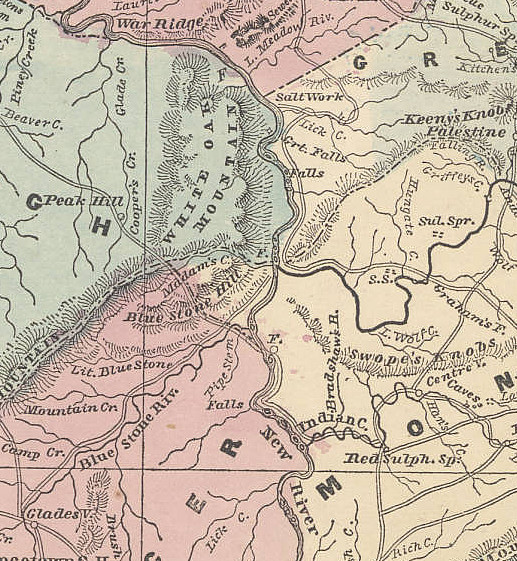