![[WV 21]](transpo/wv21.png)
![[WV 3]](transpo/wv3b.png)
![[WV 3]](transpo/wv3a.png)
![[WV 3]](transpo/wv3smap.png)
| Highway | Start | Terminus | Length (km) |
|---|---|---|---|
| WV 3 | Raleigh County line west of Jumping Branch | Greenbrier County line, Glenray | 47 |
West Virginia Route 3 is the second-longest east-west state highway in West Virginia. It crosses a broad swath of the southern third of the state, reaching from Lincoln County to Monroe County near the Virginia state line. In Summers the road links Hinton directly to Beckley and the I-77 corridor, and serves as the region's main east-west link.
WV 3 enters Summers County from the west at the crest of White Oak Mountain, the landform separating the Glade Creek and Bluestone River watersheds. The road loses 468 metres of elevation, and approaches the New River alongside Beech Run. The highway then takes a southward jog, bypassing Hinton via the Bellepoint Bridge, and follows the Greenbrier River Valley. It exits Summers County 32 kilometres upstream, just shy of Alderson.
Some precursors of this route were in place before Hinton, Summers County, or West Virginia itself were even a thing. The 1862 Lloyd Map of Virginia shows a road that parallels the New and Greenbrier rivers, following much the same course as the modern route before diverging at Lowell (labelled "Graham's Ferry"). By the end of the nineteenth century, most of the infrastructure that would form WV 3's early course was in place.
![[WV 21 map]](transpo/wv21x-22src.jpg)
(WV State Road Commission, 1922)
In 1922, West Virginia's numbered highway system debuted. Under the original plan, route numbers were assigned so that blocks of similar numbers were grouped close together on the map. Summers County was crossed by WV 20 and WV 21, the latter of which was WV 3's direct predecessor.
Not only was this highway's number different in 1922, but its routing had significant differences as well. WV 21 crossed White Oak Mountain and entered Summers County on a now-impassable road south of its current incarnation. It took a northeast tack from Jumping Branch, approaching Hinton from due west through the Madam Creek Valley. It served downtown Hinton and alternated between the south and north banks of the Greenbrier River, crossing at Browning downstream from its current bridge.
Originally, West Virginia applied the "Route 3" designation to the Midland Trail, the preeminent highway in the Kanawha River Valley. In 1926, however, WV 3 was replaced by US 60. Around the same time, the state began to streamline its highways, combining short routes end-to-end under a common number to simplify navigation and bookkeeping. And in 1931, the bulk of WV 21 was combined with WV 63 and WV 65 to form a new incarnation of WV 3!
A full list of known adjustments follows:
![[WV 3]](transpo/wv3sy.png)
![[WV 3]](transpo/wv3x-33clarksburg.jpg)
![[WV 3]](transpo/wv3x-71usgs.jpg)
![[WV 3]](transpo/wv3x-46src.png)
![[WV 3]](transpo/wv3x-c75wvdh.png)
All photos by the author, 2013 (except as otherwise noted):
![[WV 3 photo]](transpo/wv3-hinton13.jpg)
A: "Fisherman's Corner, Live Bait:" The lettering on the front of a gargantuan two-storey building that once had gas pumps in front. What tales might this place tell? None; it was demolished by 2021.
![[WV 3 photo]](transpo/wv3-bellepoint13.jpg)
![[WV 3 photo]](transpo/wv3-bellepoint13a.jpg)
B: Two historical markers in Bellepoint (Hinton's upstream exclave) that appear on WV 3 two blocks apart. Fort Culbertson predated the founding of Hinton and Summers County by nearly a century, and was one of many militarized structures erected on the frontier to protect the interests of colonialist settlers at the expense of America's pre-existing Indigenous population. Meanwhile, the Wreck on the C&O was a grisly tale conveying the dangers of late nineteenth century high-speed transportation. Newer historical markers in West Virginia are dated with a fine-print byline, while older markers are undated.
![[WV 3 photo]](transpo/wv3-talcott99.jpg)
C: 12 kilometres upstream of Bellepoint, WV 3 passes the portals of the Great Bend Tunnel of the C&O Railroad. The tunnel was a major engineering feat in the 1870s, with a nearly 2-kilometre path through brittle shale. Much of the physical effort came from the sweat of Black and immigrant labourers, including freed slaves. Over the years, the tunnel became associated with the Legend of John Henry; the tale of the strong Black steel-driving man who won a race of speed against a steam-powered drill and won...only to die in the aftermath. (Photo by the author, 1999.)
In 1972 a statue of John Henry was erected at a roadside overlook directly over the tunnel, near Talcott. The statue was relocated to the tunnel portal area in the 2010s, where it forms the centrepiece of John Henry Park.
![[WV 3 Alternate]](transpo/wv3alt.png)
![[WV 3 Alternate]](transpo/wv3special.png)
In 1954, the Bellepoint Bridge opened to traffic at the confluence of the New and Greenbrier rivers. WV 3 was soon relocated to this course, bypassing Hinton's city centre, and its old alignment was reclassified as Alternate 3.
Portions of Alternate 3 were concurrent with WV 20. The concurrency was eliminated by 1982, and the non-redundant portions of Alternate 3 were duly reconstituted as WV 107.
![[WV 3]](transpo/wv3sfract.png)
CR 3/1 through CR 3/11 were numbered off eastly from Raleigh County to Greenbrier County as part of the original fractional number allocation in 1933, with higher-numbered roads being later additions. A small cluster of 3-prefix numbers exists on the Greenbrier County line with no connection within Summers County to other roads. Four numbers were reassigned.
| Road | Names | Start | Terminus | Length (km) | Notes |
|---|---|---|---|---|---|
| 3/1 | Will Dodd Rd., Broomstraw Ridge Rd. | WV 3 west of Jumping Branch | Raleigh County line, continues as CR 22/3. | 9 | Original 1930s assignment. Central segment impassable. |
| 3/2 | Beagle Club Rd., Paul Lowe Rd. | WV 3, Jumping Branch | CR 25/3 west of Jumping Branch | 6 | Original 1930s assignment. Central segment impassable. |
| 3/3 | Robin Roost Rd. | WV 3, Jumping Branch | CR 27 south of Nimitz | 3 | Original 1930s road with numbers assigned from west to east. |
| 3/4 | Sand Knob Rd. | WV 3, Nimitz | dead end | 6 | Original 1930s road with numbers assigned from west to east. |
| 3/5 | West Woodrumtown Rd., East Woodrumtown Rd. | WV 3 east of Bellepoint | dead end | 5 | Original 1930s road with numbers assigned from west to east. |
| 3/6 | East Woodrumtown Rd. | WV 3 east of Bellepoint | CR 3/5, Woodramtown Branch | insignificant | Original 1930s road with numbers assigned from west to east. |
| 3/7 | John Cook-Nursing Home Rd., Redwing Ln. | WV 3, Hilldale | CR 13 | 3 | Original 1930s assignment. Probable former alignment of WV 3. |
| 3/8 | Camp Lightfoot Rd. | WV 3 near Hilldale | dead end | 6 | Original 1930s assignment. Originally ended at a ferry dock connecting to CR 29. |
| 3/9 | Valley Heights Rd. | WV 3 & 12 near Pence Springs | CR 6 near Pence Springs | 3 | Original 1930s assignment. South end realigned after 1949. |
| 3/10 | Eagle Branch Rd. | WV 3 & 12, Glenray | dead end | 3 | Original 1930s road with numbers assigned from west to east. |
| 3/11 | Big Branch Rd. | WV 3 & 12, Glenray | Greenbrier County line, continues as CR 3/11 (formerly CR 42/1). | 6 | Original 1930s assignment. Ducks in and out of Greenbrier County near north end. Portion formerly CR 3/21. |
| 3/12 | Pie Hollow Rd. | WV 3 & 12, Talcott | dead end | insignificant | |
| 3/13 (old) | Tolley Ln. | WV 3 & 12, Pence Springs | dead end | insignificant | Deleted by 1946. |
| 3/13 | Unique Dr. | WV 3 & 12, Pence Springs | dead end | insignificant | |
| 3/14 | Bruce Allen Rd. | WV 3 & 12 east of Hilldale | dead end | 5 | |
| 3/15 | Huston Rd. | WV 3 & 12, Talcott | dead end | insignificant | Partially a former alignment of WV 3. |
| 3/16 | Old Pluto Rd. | CR 3/1 north of Jumping Branch | Raleigh County line, continues as CR 22/3. | insignificant | |
| 3/17 | Bennett Mountain Rd. | CR 3/16 north of Jumping Branch | Raleigh County line, continues as CR 27/11. | insignificant | |
| 3/18 | West Clayton Rd. | WV 3 & 12, Pence Springs | CR 6 near Pence Springs | insignificant | |
| 3/19 (old) | Westview Rd., Eastview Rd. | dead end near Patterson Creek | dead end near Meadow River | 4 | No direct connection to WV 3 in Summers County. Later CR 3/23. |
| 3/19 | Marvin Deeds Rd. | WV 3, Jumping Branch | dead end | 2 | Partially a former alignment of WV 3. |
| 3/20 (old) | Cedar Ave. | WV 3, Bellepoint | dead end | insignificant | Formerly CR 23, stubbed off by the construction of the Bluestone Dam. Actually coexisted contemporaneously with the current CR 3/20. Deleted by the 1970s. |
| 3/20 | Keeney Mountain Rd. | CR 3/23 | Greenbrier County line, continues as CR 42/2. | insignificant | No direct connection to WV 3 in Summers County. |
| 3/21 (old) | Big Branch Rd. | Greenbrier County line north of Glenray | Greenbrier County line, continued as CR 42/1. | insignificant | Now part of CR 3/11. |
| 3/21 | Broomstraw Ridge Rd., Mark Meador Rd., Madams Creek Rd. | WV 3, Jumping Branch | WV 20, Brooklin | 10 | Formerly CR 12. Partially a former alignment of WV 3. |
| 3/22 | Glen Ray Rd. | Monroe County line, Glenray | dead end | insignificant | No direct connection to WV 3 in Summers County. |
| 3/23 | Westview Rd., Eastview Rd. | dead end near Red Spring Branch | dead end near Meadow River | 6 | Never touched WV 3. Formerly CR 3/19. |
| 3/24 | Talcott School Rd. | WV 3 & 12, Talcott | dead end | insignificant | |
| 3/25 | (unknown) | ||||
| 3/26 | (unknown) | ||||
| 3/27 | (unknown) | ||||
| 3/28 | (unknown) | ||||
| 3/29 | (unknown) | ||||
| 3/30 | (unknown) | ||||
| 3/31 | (unknown) | ||||
| 3/32 | Greenbrier Dr. | Monroe County line, Glenray | HARP 911, Glenray | insignificant | |
| 3/33 | (unknown) | ||||
| 3/34 | (unknown) | ||||
| 3/35 | (unknown) | ||||
| 3/36 | Tom Mack Rd. | WV 3 west of Jumping Branch | Raleigh County line, continues as CR 3/36. | insignificant | Partially impassable. |
| 3/37 | Altare Rd. | WV 3 & 12, Talcott | dead end | insignificant | |
| 3/38 | Riverside Rest Rd. | WV 3 & 12, Barnettown | dead end | insignificant | |
| 3/39 | (unknown name) | WV 3 west of Jumping Branch | CR 3/36 near Raleigh County line | insignificant | Impassable. |
| 3/40 | 8th St. | CR 3/22, Glenray | dead end | insignificant | |
| 3/41 | Teddy Willis Rd. | CR 3/21, Brooklin | dead end | 3 | |
| 3/42 | Lowell Pedestrian Bridge Rd. | WV 3 & 12 east of Talcott | CR 15, Lowell | dead end | Former C&O Railroad bridge crossing, closed to traffic. |
| 3/43 | Clark St., Donald Ave., Lookout Ave. | WV 3 & 12, Hilldale | itself (loops) | insignificant | |
| 3/44 | Kesler Ln. | WV 3 & 12 east of Talcott | WV 3 & 12 east of Talcott | insignificant | Former alignment of WV 3. |
| 3/45 | Jack Lilly Rd. | CR 3/4 near Nimitz | dead end | insignificant | |
| 3/46 | Graham House Rd. | WV 3 & 12 east of Talcott | dead end | insignificant | Partially a former alignment of WV 3. |
| 3/46 (Raleigh) | Freezeland Mountain Rd. | CR 3/1 north of Jumping Branch | Raleigh County line, continues as CR 26/3. | 3 | Despite being entirely in Summers County, this road is maintained by Raleigh County and fits its numbering system; hence the duplication. |
| 3/47 | John Tolbert Rd. | WV 3 & 12, Hilldale | dead end | insignificant | |
| 3/48 | Eagle Branch Rd. | CR 3/10 near Glenray | CR 3/10 near Glenray | 3 | |
| 3/49 | J. M. Whanger Rd. | WV 3 & 12, Talcott | WV 3 & 12, Talcott | insignificant | Partially a former alignment of WV 3. |
| 3/50 | Wade Harvey Rd. | CR 3 west of Jumping Branch | dead end | insignificant | Truncated |
| 3/51 | Bolling Rd. | CR 3/3 near Nimitz | dead end | insignificant | |
| 3/52 | Roy Keaton Rd. | WV 3 near Jumping Branch | dead end | insignificant | |
| 3/53 | Doug Craft Rd. | WV 3 & 12, Hilldale | dead end | insignificant | |
| 3/54 | Donald Ave. | CR 3/43, Hilldale | CR 3/43, Hilldale | insignificant | |
| 3/55 | Penny Ln. | WV 3 & 12, Talcott | CR 3/49, Talcott | insignificant | |
| 3/56 | Mock Farm Rd. | WV 3 east of Nimitz | dead end | 2 | |
| 3/57 | Falling Branch Rd. | WV 3 & 12 near Glenray | dead end | insignificant | |
| 3/58 | Colonial Manor Dr. | WV 3 near Jumping Branch | CR 3/2 near Jumping Branch | insignificant | |
| 3/59 | Colonial Manor Ln. | CR 3/2 near Jumping Branch | CR 3/58 near Jumping Branch | insignificant | |
| 3/60 | Sammy Ball Rd. | CR 3/21 west of Brooklin | dead end | insignificant | |
| 3/61 | New Autumn Estates Rd. | CR 3/21 near Jumping Branch | dead end | insignificant | |
| 3/62 | Park St. Circle | CR 3/43, Hilldale | CR 3/43, Hilldale | insignificant | |
| 3/63 | Oakview Ln. | CR 3/3 near Jumping Branch | dead end | insignificant | |
| 3/64 | Summers Hospital Rd. | WV 3, Bellepoint | continues as a Hinton city street | insignificant | |
| 3/65 | Skyview Dr. | CR 3/58 near Jumping Branch | dead end | insignificant |
![[Home]](home.gif) The Network
The Network![[Back]](back.gif) Summers County
Summers County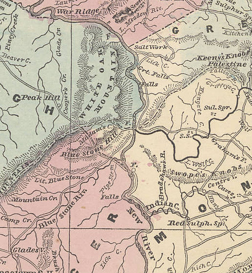