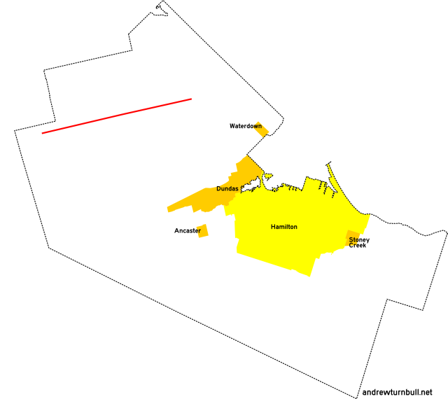
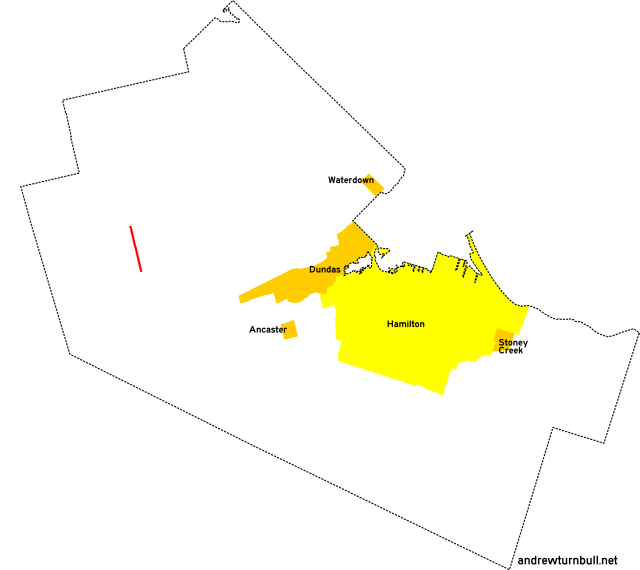
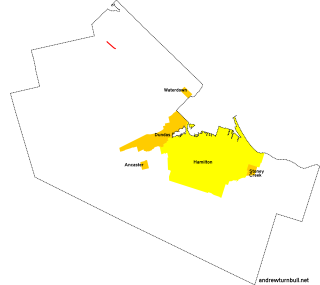
![[Hamilton, ON highway map]](transpo/rr500.png)
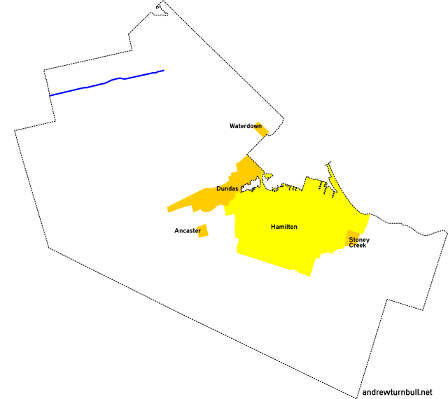
The Town of Flamborough was formed through the 1974 administrative consolidation of three historical townships (Beverly, West Flamborough, and East Flamborough), less the portions that had been annexed by Halton County (Burlington) and the Waterloo Region (Cambridge) in the sixteen years before.
| 501 | 503* | 504 | 505* | 507 | 508 | 509 | |||
| 518 | 519 | ||||||||
| 520 | 521 | 528 | |||||||
| 535 | 536 | 538 | |||||||
| 542 | 543 | 546 | |||||||
| 551 | 552 | 554 | 559 | ||||||
| 97 | |||||||||
= Based on pre-1979 regional road number
= Based on Ontario provincial highway number
= Random or sequential numbers
* = Continues across municipal boundary with a change of leading digit
| Highway | Map (click to enlarge) | Names | Start | Terminus | Length (km) |
|---|---|---|---|---|---|
RR 501 | |||||
|
|
Safari Rd. | Sheffield Rd., Sheffield | ON 6 north of Millgrove | 18 |
|
Previously: RR 1. Follows Concession Line 7. |
|||||
RR 503 | |||||

|

|
Lynden Rd. | ON 5 east of Troy | ON 99, Lynden (continues as RR 203) | 4 |
|
Previously: RR 3. |
|||||
RR 504 | |||||

|

|
Brock Rd. | Freelton Rd. (old ON 6), Freelton | ON 8, Bullocks Corners | 15 |
|
Previously: RR 4, initially with no changes. Adjustments: Realigned near its intersection with ON 5 by 1982, leaving behind several disconnected stubs of Old Brock Road. |
|||||
RR 505 | |||||
|

|
Millgrove Side Rd. Sydenham Rd. |
ON 6, Millgrove | Dundas town limits (continues as RR 305). | 7 |
|
Previously: RR 5 (south of ON 5). Lengthened from that road's original incarnation. |
|||||
RR 507 | |||||

|

|
Parkside Dr. | ON 6 north of Clappison Corners | Halton Region line east of Waterdown | 6 |
|
Previously: RR 7, 7A. Follows Concession Line 4. |
|||||
RR 508 | |||||
|

|
Centre Rd. Hamilton St. N. |
Campbellville Rd. north of Mountsburg | Parkside Dr., Waterdown | 16 |
|
Previously: RR 8. |
|||||
RR 509 | |||||
|

|
Mill St. | ON 5, Waterdown | Halton Region line at Mountain Brow Rd., Waterdown | insignificant |
RR 518 | |||||

|

|
Campbellville Rd. | ON 6 north of Freelton | Halton Region line east of Mountsburg | 6 |
|
Previously: RR 18, with no changes or adjustments. Follows Concession Line 13. |
|||||
RR 519 | |||||
|
|
Woodhill Rd. | ON 8, Rockton | ON 5 east of Troy | 4 |
|
Previously: RR 19, with no changes or adjustments. |
|||||
RR 520 | |||||

|

|
Westover Rd. | Safari Rd. north of Westover | ON 8, Peters Corners | 8 |
|
Previously: RR 20. Lengthened from that road's original incarnation. |
|||||
RR 521 | |||||
|

|
Millgrove Rd. | Westover Rd. south of Westover | ON 6, Millgrove | 11 |
|
Previously: RR 21. Extended westward from that road's original incarnation. Follows Concession Line 5. |
|||||
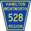
RR 528 | |||||
|

|
Old Highway 8 | ON 8, Sheffield | ON 8, Sheffield | 2 |
|
Previously: ON 8 (duh). Section was left behind by a bypass. |
|||||
RR 535 | |||||

|

|
Sheffield Rd. | Safari Rd., Sheffield | ON 5, Troy | 8 |
|
Previously: RR 35. Truncated from the original incarnation of CR 35, which passed through an area ceded to Waterloo. Includes two jogs, one of 220m along Old Highway 8 in Sheffield (forming an invisible concurrency with RR 528), and one of 400m along Concession 4 West. |
|||||
RR 536 | |||||

|

|
Carlisle Rd. | ON 6 west of Carlisle | Halton Region line east of Carlisle | 6 |
|
Previously: RR 36, with no changes or adjustments. Follows Concession Line 9. |
|||||
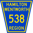
RR 538 | |||||
|
|
Rockton Rd. | ON 8, Rockton | ON 8, Rockton | 2 |
|
Previously: ON 8. Section was left behind by a bypass. |
|||||
RR 542 | |||||

|
|
Evans Rd. | Parkside Dr. north of Waterdown | ON 5 north of Waterdown | insignificant |
|
Previously: RR 42. |
|||||
RR 543 | |||||
|

|
6th Concession Rd. | ON 6, Millgrove | Centre Rd., Flamboro | 3 |
|
Previously: RR 43. East end truncated from that road's original incarnation. |
|||||
RR 546 | |||||
|

|
Gore Rd. | ON 52 on Wellington County line east of Clyde | Wellington CR 35 | insignificant |
|
Previously: RR 46. |
|||||
RR 551 | |||||

|
|
Freelton Rd. 11th Concession Rd. |
ON 6, Freelton | ON 6, Freelton | 2 |
|
Previously: ON 6, CR 51. Section was left behind by a bypass. |
|||||
RR 552 | |||||
|
|
Cooper Rd. | Wellington County line east of Clyde | RR 97 west of Valens | 3 |
| Kirkwall Rd. | RR 97 north of Kirkwall | ON 8, Rockton | 8 | ||
|
Previously: ON 52. Added in 1986. At the time this highway was added to the regional road system, it consisted of two segments separated by a 2-km jog along RR 97. It's unclear whether the "552" designation applied to both segments (with a discontinuity or concurrency in between), or to the south segment only. |
|||||
RR 554 | |||||

|

|
Hamilton St. | Parkside Dr., Waterdown | ON 5, Waterdown | insignificant |
|
Previously: RR 54, with no changes or adjustments. |
|||||
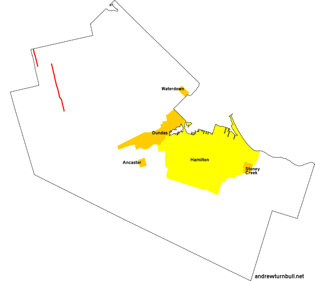
RR 559 | |||||
|
|
Milburough Line | Wellington County line north of Mountsburg | Campbellville Rd. north of Mountsburg | 3 |
|
Added in 1979; probably unnumbered before. Follows the regional line. |
|||||
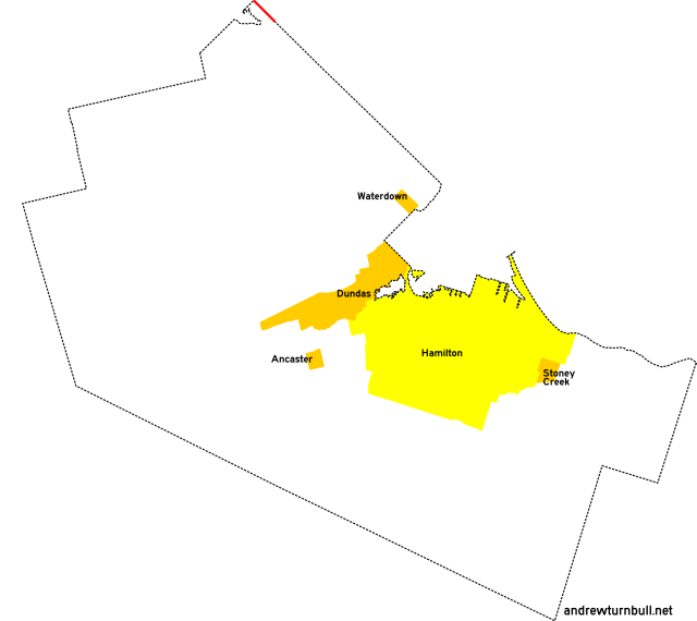
RR 97 | |||||
|
|
Regional Rd. 97 | Waterloo Region line east of Clyde | ON 6, Freelton | 14 |
|
Previously: ON 97. Added in 1984. Still in commission today. Note: Although RR 97 was located in Flamborough, the regional government elected to retain its original two-digit number instead of turning it into "597." |
|||||
![[Home]](home.gif) The Network
The Network![[Back]](back.gif) Hamilton
Hamilton![[Forward]](forward.gif) 600 series
600 series