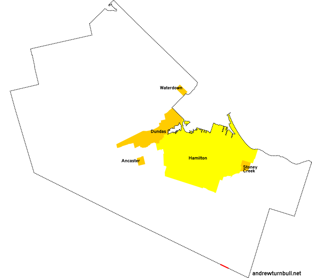
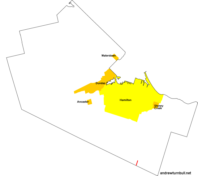
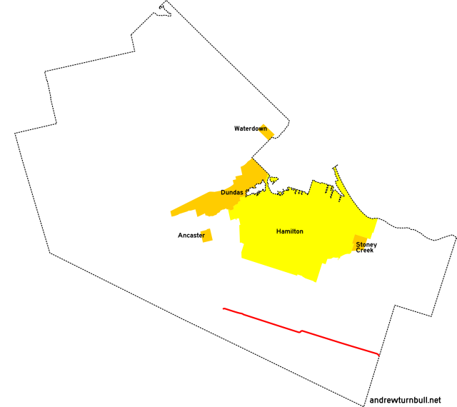
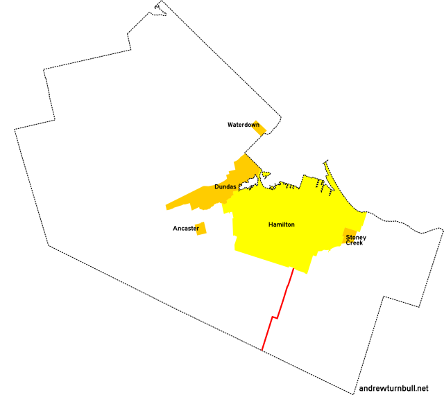
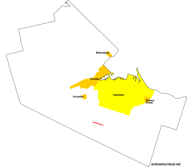
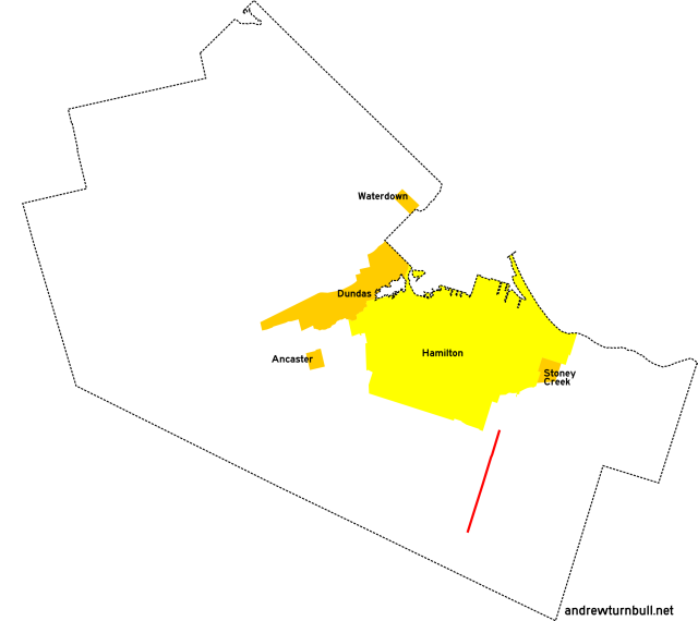
![[Hamilton, ON highway map]](transpo/rr600.png)
The Township of Glanbrook was formed from the administrative consolidation of Glanford and Binbrook townships. (Why they chose the name "Glanbrook" and not "Binford," I can't imagine.)
| 609 | |||||||||
| 610 | 612 | 613 | 614 | ||||||
| 622* | 626* | 629 | |||||||
| 633* | 634* | 637 | |||||||
| 640 | |||||||||
| 652 | |||||||||
= Based on pre-1979 regional road number
= Based on Ontario provincial highway number
= Random or sequential numbers
* = Continues across municipal boundary with a change of leading digit
| Highway | Map (click to enlarge) | Names | Start | Terminus | Length (km) |
|---|---|---|---|---|---|
RR 609 | |||||
|

|
3rd Line Rd. | Haldimand County line east of Sinclairville | Niagara Region line east of Sinclairville | insignificant |
|
Previously: RR 9A. This 350-metre "highway" grazes the southeastern extremity of Hamilton-Wentworth between Haldimand and Niagara, and does not connect directly to any other Hamilton-maintained regional road. |
|||||
RR 610 | |||||
|
|
Haldibrook Rd. | ON 56 east of Blackheath | Glanbrook Landfill entrance | insignificant |
|
Added in 1979; probably unnumbered before. Serves as a landfill access road, following the regional line. |
|||||
RR 612 | |||||
|

|
Harrison Rd. | Kirk Rd. W. | Binbrook Conservation Area entrance | insignificant |
|
Added in 1979; unnumbered before. Serves as a park access road. |
|||||
RR 613 | |||||
|
|
Blackheath Rd. | ON 56 north of Blackheath | Haldibrook Rd., Blackheath | 2 |
|
Previously: ON 56, RR 13. Section was left behind by a bypass. Adjustments: At some point after 1986 the north end of this road was stubbed off, removing direct access from Highway 56. |
|||||
RR 614 | |||||
|

|
Kirk Rd. W. | Fletchers Rd. southwest of Binbrook | ON 56 south of Binbrook | 2 |
|
Added in 1979; probably unnumbered before. Follows Concession Line 7. |
|||||
RR 622 | |||||
|
|
White Church Rd. Binbrook Rd. |
Glancaster Rd. (continues from RR 222) | Niagara Region line east of Binbrook | 19 |
|
Previously: RR 22. Follows Glanford Twp. Concession Line 6 and Binbrook Twp. Concession Line 4. Succeeded by: RR 65, which is still in commission today. |
|||||
RR 626 | |||||
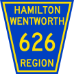
|

|
Miles Rd. | Hamilton city limits west of Hannon (continues from RR 126) | Dickenson Rd. | 2 |
|
Previously: RR 26. |
|||||
RR 629 | |||||
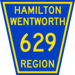
|

|
Dickenson Rd. | ON 6 north of Mount Hope | Nebo Rd. south of 3 | 5 |
|
Previously: RR 29. Lengthened from that road's original incarnation. Follows Glanford Twp. Concession Line 3. |
|||||
RR 633 | |||||
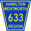
|
|
Nebo Rd. Tyneside Rd. |
Hamilton city limits, Hannon (continues from RR 133) | Handimand County line, Tyneside | 10 |
|
Previously: RR 33. Highway takes a jog west at White Church Road via an invisible 600m concurrency with RR 622. |
|||||
RR 634 | |||||
|

|
Woodburn Rd. | ON 20 east of Elfrida (continues from RR 434) | Binbrook Rd. east of Binbrook | 6 |
|
Previously: RR 34. Truncated from that road's original incarnation, which continued through to the Haldimand County line. |
|||||
RR 637 | |||||
|
|
Airport Rd. | Glancaster Rd. west of Mount Hope | ON 6, Mount Hope | 3 |
|
Previously: RR 37, with no changes or adjustments. Follows Glanford Twp. Concession Line 5. |
|||||
RR 640 | |||||
|
|
Fletcher Rd. | Rymal Rd. (ON 53) west of Elfrida | Kirk Rd. W. south of Binbrook | 8 |
|
Previously: RR 40. Lengthened from that road's original incarnation. |
|||||
RR 652 | |||||
|

|
Homestead Dr. | ON 6, Mount Hope | ON 6, Mount Hope | 2 |
|
Previously: ON 5 (1925-27), ON 6 (1927-5?), and RR 52. Section was left behind by a bypass. |
|||||
![[Home]](home.gif) The Network
The Network![[Back]](back.gif) Hamilton
Hamilton