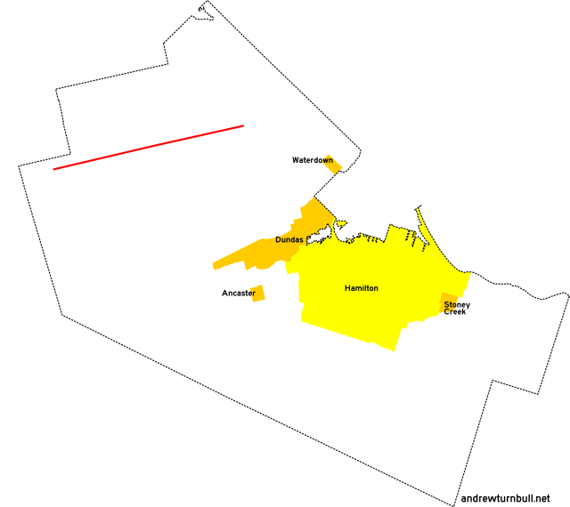
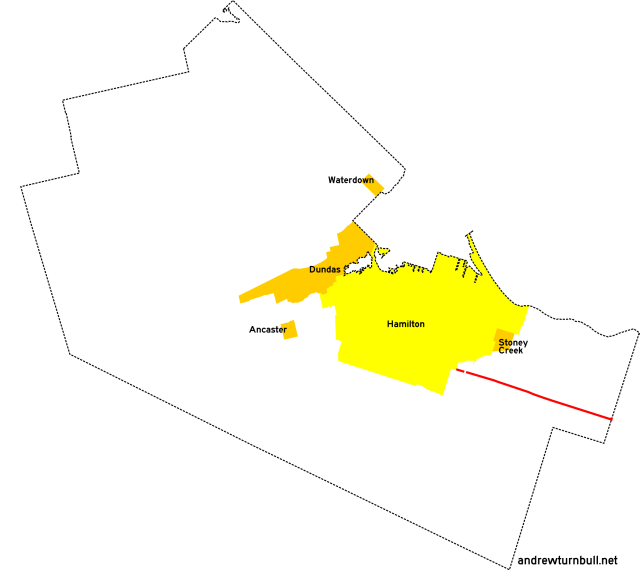
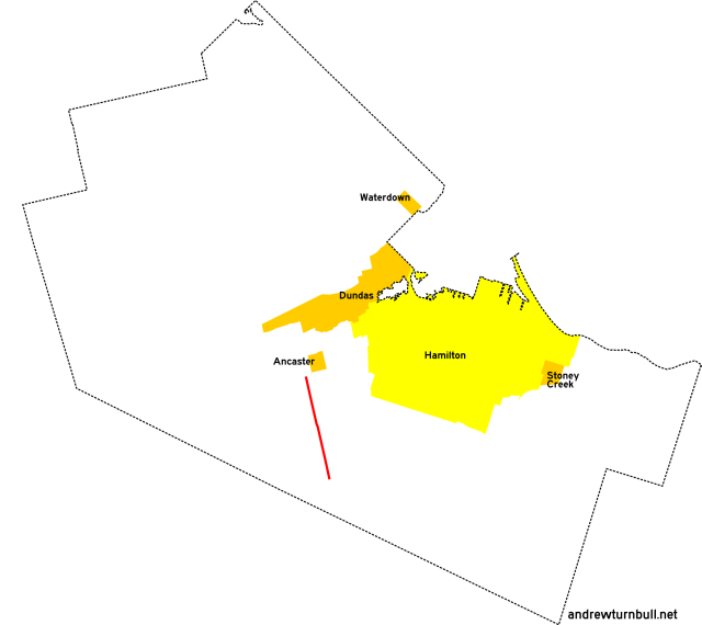
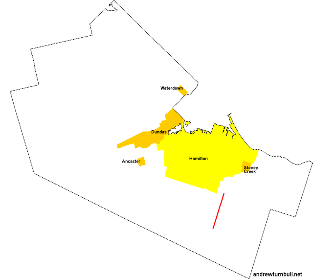
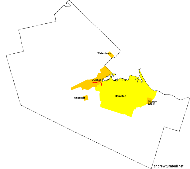
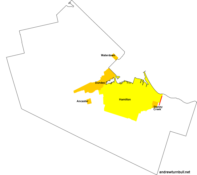
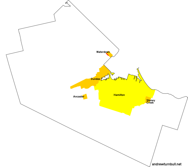
![[Hamilton, ON highway map]](transpo/rr-map1.png)
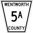
(Wentworth County road system, circa 1960)
| Highway | Map (click to enlarge) | Names | Start | Terminus | Length (km) |
|---|---|---|---|---|---|
CR/RR 1 | |||||

|
|
Safari Rd. | Sheffield Rd., Sheffield | ON 6 north of Millgrove | 18 |
|
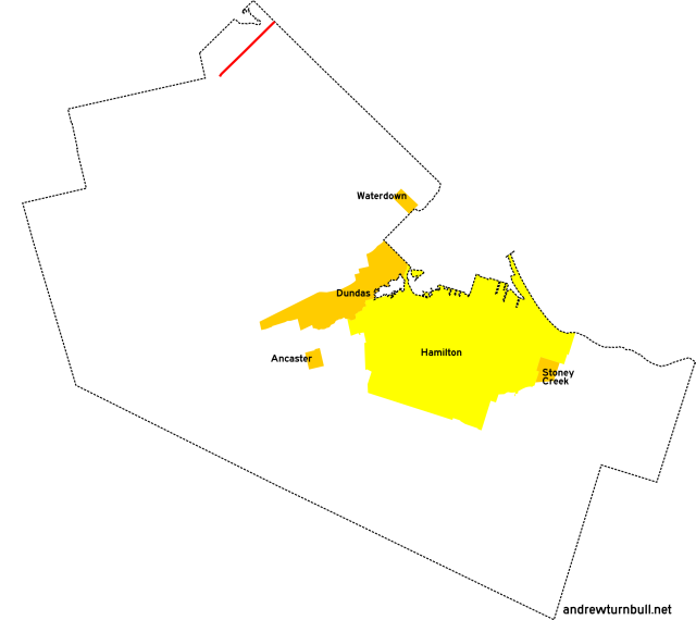
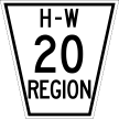
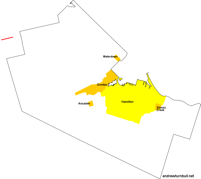
Added by 1969; unnumbered before. Follows Concession Line 7. Adjustments: CR 1 originally started at Sheffield Road (CR 35) in Sheffield and ended at Westover Road (CR 20) north of Westover, resulting in a route length of 10 km. Lengthened by 1977. Succeeded by: RR 501. |
|||||
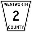
CR 2 | |||||
|

|
Indian Trail | Lynden Rd. west of Jerseyville | Brant County line west of Jerseyville | 2 |
|
Previously: CR 3A. CR 2 was a short-lived renumbering of CR 3A, with its only verified appearance being a 1969 county map. By 1973 the road had been re-renumbered as CR 14; perhaps to avoid confusion with ON 2, which passed nearby. Succeeded by: CR 14 (1973), unnumbered road (1977). |
|||||
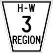
CR/RR 3 | |||||
|

|
Lynden Rd. Jerseyville Rd. Sunnyridge Rd. |
ON 5 east of Troy | Wilson St. (ON 2/53) west of Alberton | 13 |
|
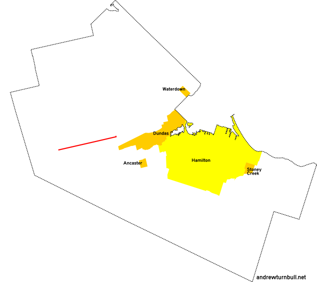
Strangely, CR 3 per se originally incorporated a 1.6 km spur forking west of Jerseyville to the Brant County line. This is distinct from the CR 3A spur, and is explicitly shown on a 1967 county map. By 1969, the spur had been renumbered as CR 17 to prevent confusion. Succeeded by: CR 17 (1973), unnumbered road (1977) |
|||||
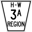
| (Shown above in pink.) | Indian Trail | Lynden Rd. west of Jerseyville | Brant County line west of Jerseyville | 2 |
|
CR 3A appeared on maps through 1967. It was renumbered twice in the following decade, then struck from the list of numbered roads. Succeeded by: CR 2 (1969), CR 14 (1973), unnumbered road (1977) |
|||||
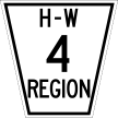
CR/RR 4 | |||||
|

|
Brock Rd. | Freelton Rd. (old ON 6), Freelton | ON 8, Bullocks Corners | 15 |
|
Succeeded by: RR 504. Some portions of the original road near its intersection with ON 5 were stubbed off by a later realignment. |
|||||
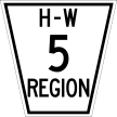
CR/RR 5 | |||||
|

|
Millgrove Side Rd. Sydenham Rd. |
ON 6, Millgrove | Dundas town limits | 7 |
|
Adjustments: CR 5 originally had its north terminus at ON 5, resulting in a route length of 4 km. The route was extended north to Millgrove by 1967. Succeeded by: RR 505. |
|||||
| (Shown above in pink.) | Rock Chapel Rd. | Sydenham Rd. north of Dundas | ON 5 north of Dundas | 2 |
|
Added by 1952, and struck from the list of numbered roads by 1973. Succeeded by: Unnumbered road. |
|||||
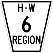
CR/RR 6 | |||||
|

|
Mt. Albion Rd. Upper Mt. Albion Rd. |
(1940) King St., Bartonville | Rymal Rd. (ON 53) east of Hannon | 6 |
| (1960) Mud St., Mt. Albion | Rymal Rd. (ON 53) east of Hannon | 2 | |||
|
Adjustments: The original configuration of CR/RR 6 covered a considerable distance in the Red Hill Creek Valley, which was then outside Hamilton city limits. The city encroached on the road by 1952, and by 1960 the entire portion north of Mt. Albion was subsumed into the street grid. Due to the construction of the Lincoln M. Alexander and Red Hill Valley parkways in the 1990s and 2000s, the course of CR/RR 6 became bisected in four places and is no longer drivable in its entirety:
Succeeded by: RR 406. |
|||||
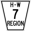
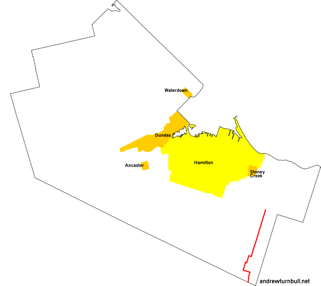
CR/RR 7 | |||||
|

|
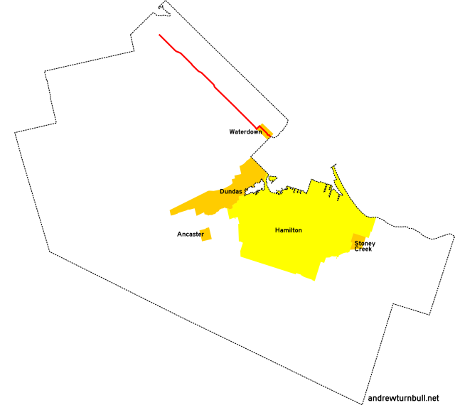
Parkside Dr. Mill St. Waterdown Rd. N. Shore Blvd. E. |
ON 6 north of Clappison Corners | (1940) ON 2, Aldershot | 12 |
| Parkside Dr. | (1969) Halton Region line east of Waterdown | 6 | |||
|
Followed Flamborough East Concession Line 4. Adjustments: In 1958 the Aldershot portion of Wentworth County was annexed by the city of Burlington in Halton County, resulting in the Wentworth-maintained portion of this route being truncated by 6 km. By 1969, CR 7 was realigned east of Mill Street to follow CR 7A's former course east to the Halton County line. |
|||||
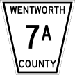
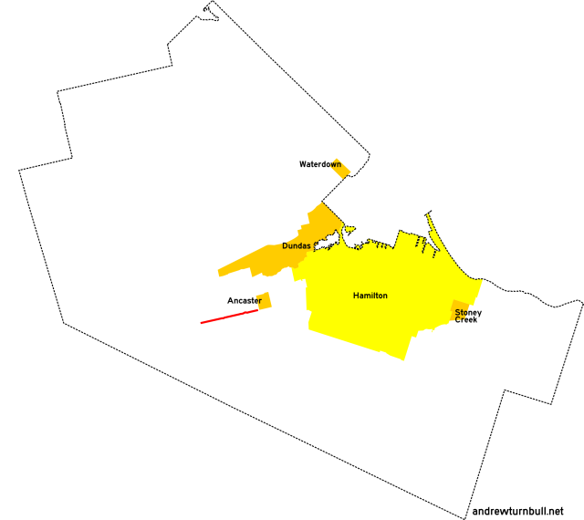
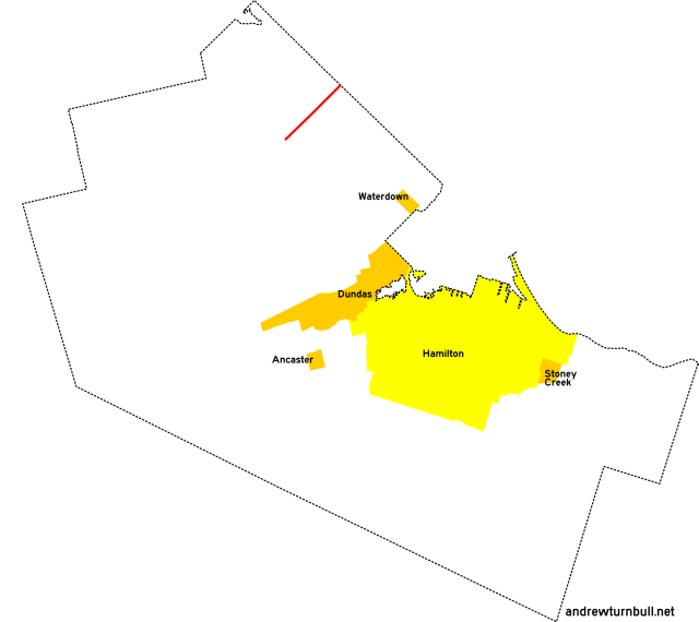
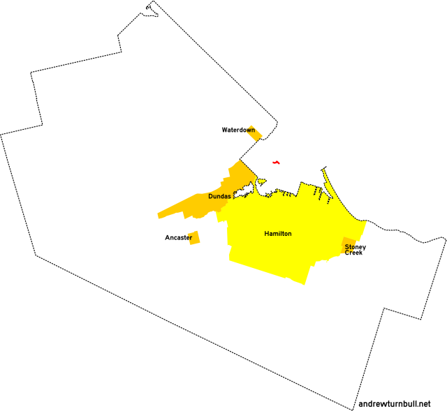
| (Shown above in red.) | Parkside Dr. | Hamilton St., Waterdown | Halton Region line east of Waterdown | 3 |
|
Added by 1952, initially as an insignificant stub road entirely within Waterdown village limits; extended to the county line by 1960. Followed East Flamborough Concession Line 4. Incorporated into the CR 7 parent route by 1969. |
|||||
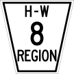
CR/RR 8 | |||||
|
|
Centre Rd. Main St. N. Snake Rd. Spring Gardens Rd. Valley Inn Rd. |
(1940) Carlisle Rd., Carlisle | ON 2 west of Aldershot (two forks) | 17 |
|
Centre Rd. Main St. N. |
(1960) Campbellville Rd. north of Mountsburg | Halton County line, Waterdown | 18 | ||
|
Centre Rd. Hamilton St. N. |
(1974) Campbellville Rd. north of Mountsburg | Parkside Dr., Waterdown | 16 | ||
|
CR 8 was originally the longest numbered route in East Flamborough Township, though its configuration changed several times in its history. Much of the original southern extent of the road now falls within the natural areas of the Royal Botanical Gardens, and is no longer accessible to motorized traffic. Adjustments: In 1958 the Aldershot portion of Wentworth County was annexed by the city of Burlington in Halton County, resulting in the south end of the Wentworth-maintained portion of this route being truncated by 6 km. The route was extended north to Mountsburg by 1952, more than compensating for the lost distance. CR 8 was taken off of Main Street in Waterdown by 1974, resulting in its final endpoint at Parkside Drive. Succeeded by: RR 508. Note: Presently, Centre Road no longer connects directly to Main Street. |
|||||
CR/RR 9 | |||||
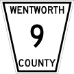
|

|
(Old) Guelph Rd. | ON 6, Clappison Corners | ON 2 near Desjardins Canal | 4 |
|
Struck from the list of numbered roads in 1967. The number was subsequently reused. Succeeded by: Unnumbered road. Note: Presently, Old Guelph Road no longer connects directly to ON 6. |
|||||

|

|
Mill St. S. | ON 5, Waterdown | Halton Region line at Mountain Brow Rd., Waterdown | insignificant |
|
Previously: CR 7. By 1969, the CR 9 designation had been recycled and applied to a Waterdown road segment orphaned by CR 7's contemporaneous realignment. Succeeded by: RR 509. |
|||||
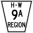
|

|
3rd Line Rd. | Haldimand County line east of Sinclairville | Niagara Region line east of Sinclairville | insignificant |
|
RR 9A might be the strangest of Hamilton-Wentworth's numbered roads. Added by 1977, this 350-metre "highway" grazed the extreme southeastern corner of the map. It didn't connect to RR 9 (or any other Hamilton-Wentworth regional road), but did function as a connecting link between Haldimand County CR 9 and Niagara Region RR 9. Succeeded by: RR 609. |
|||||
CR/RR 10 | |||||
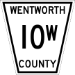
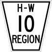
|

|
Scenic Dr. | Mohawk Rd. W., Hamilton | Garth St., Hamilton | 5 |
|
CR 10 was the only Wentworth County road that was split between directional alignments with "E" (east) and "W" (west) suffixes. Even more strangely, the alignments never touched each other, though both branched off from CR 15 to skirt the edge of the Niagara Escarpment. By 1960, all but 1.4 km of CR 10W became subsumed within Hamilton city limits. By 1969 this segment had been renumbered as simply "10," since CR 10E had by then disappeared from the map. Succeeded by: RR 210. |
|||||
| (Shown above in pink.) |
Concession St. Mountain Brow Blvd. Mud St. |
Upper Gage Ave., Hamilton | Mt. Albion Rd. (historic), Mt. Albion | 5 |
|
CR 10E was the longer of 10's directionally-split "twins," though it had a shorter duration of existence. By 1952, all of the road had become subsumed into the City of Hamilton except for a southernmost extremity that was left unlabelled on maps. By 1960, this segment had also been absorbed. Succeeded by: RR 123. |
|||||
CR/RR 11 | |||||
|
|
Mud St. | Upper Mt. Albion Rd., Mt. Albion | Niagara Region line east of Tweedside | 13 |
|
Followed Saltfleet Concession Line 7. Succeeded by: RR 411. In the late 1990s, the portion of Mud Street near RR 11's historical terminus was realigned to interface with the Lincoln M. Alexander Parkway, leaving behind a stub named Old Mud. |
|||||
CR/RR 12 | |||||
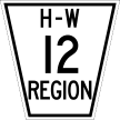
|

|
King St. | Kenilworth Ave., Hamilton | ON 8 east of Stoney Creek Village | 7 |
|
CR 12 consisted of the portion of King Street falling outside Hamilton city limits. As the city limits expanded east between 1940 and 1960, CR 12 was progressively trimmed, eventually settling into a 3 km stub with Centennial Parkway (ON 20) as its west terminus. |
|||||
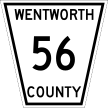
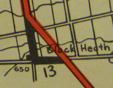
CR/RR 13 | |||||
|

|
Blackheath Rd. Haldibrook Rd. |
ON 56 north of Blackheath | ON 56 east of Blackheath | 3 |
|
Previously: ON 56; section was left behind by a bypass. Added to the county road system by 1960, and unambiguously labelled on maps by 1963. Official maps are inconsistent over whether Haldibrook Road was actually part of RR 13. Most maps through 1974 show this segment as part of the route, while later maps generally do not. Succeeded by: RR 613. |
|||||
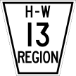
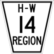
CR/RR 14 | |||||
|

|
Market St. Creighton Rd. |
King St. (ON 8), Dundas | Governors Rd. (ON 99), Dundas | insignificant |
|
Verified as a numbered road from 1952 to 1967, then subsumed as a Dundas city street. The number was subsequently reused. Succeeded by: Unnumbered road. |
|||||
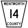
|
|
Indian Trail | Lynden Rd. west of Jerseyville | Brant County line west of Jerseyville | 2 |
|
By 1973, the CR 14 designation had been recycled and applied to a different road as CR 3A's second renumbering within a decade. It was short-lived, and by 1977 it had been struck from the list of numbered roads. Succeeded by: Unnumbered road. |
|||||
CR/RR 15 | |||||
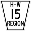
|

|
Mohawk Rd. | Wilson St. (ON 2), Ancaster Village | (1940) Mountain Brow Blvd., Hamilton | 13 |
| Wilson St. (ON 2), Ancaster Village | (1960) Hamilton city limits east of Ancaster | 4 | |||
|
The east portion of this road follows Concession Line 6 and became subsumed within Hamilton city limits by 1952, resulting in the abbreviation of the numbered designation on later maps. Adjustments: The routing of Mohawk Road was altered by the construction of ON 403 in the 1960s, resulting in a stub called Old Mohawk Road. The routing was altered again when the Lincoln M. Alexander Parkway was completed in the 1990s, extending the Old Mohawk stub and leaving Mohawk Road itself as a discontinuity. |
|||||
| (Shown above in pink.) |
McNiven Rd. Golf Links Rd. Halson St. |
Mohawk Rd. east of Ancaster Village | Wilson St. (ON 2), Ancaster Village | 2 |
|
An odd, J-shaped alternate fork for Mohawk Road. Added by 1952, and struck from the list of numbered roads by 1967. Succeeded by: Unnumbered road; CR 48, RR 248 (McNiven segment) |
|||||
CR/RR 16 | |||||

|
|
Fiddlers Green Rd. | Jerseyville Rd., Ancaster Village | Carluke Rd. near Carluke | 8 |
|
Adjustments: CR 16 originally had its north terminus at ON 2. By 1973 it had been extended north a trivial distance to intersect with CR 23, commissioned at the same time. Succeeded by: RR 216. |
|||||
CR/RR 17 | |||||
|

|
Parkdale Ave. | Burlington St., Hamilton | King St., Bartonville | 3 |
|
Appeared by 1940. By 1952 CR 17 and its two spur roads (described below) had become completely subsumed within Hamilton city limits. The number was subsequently reused. Succeeded by: RR 170. |
|||||
| (Shown above in pink.) | Leaside Rd. | Burlington St., Hamilton (no longer connects) | Van Wagners Beach Rd., Hamilton Beach (no longer connects) | insignificant |
|
A spur road near CR 17's north end, effectively functioning as a cutoff between what was then ON 20 and ON 20A. Interestingly, it appears that CR 17A didn't actually connect to CR 17, as a short segment of Burlington Road was in the way. |
|||||

| (Shown above in pink.) | Main Street East | Parkdale Ave. S., Hamilton | Main St. (ON 8), Hamilton | insignificant |
|
A second numbered spur road existed near CR 17's south end, carrying the stub of Main Street sandwiched between ON 8's southward deviation and the historic Hamilton Airport. This was the only known appearance of a "B" suffix on a Wentworth County or Hamilton-Wentworth regional road. |
|||||
|

|
Jerseyville Rd. | Brant County line west of Jerseyville | Lynden Rd. west of Jerseyville | 2 |
|
Previously: CR 3 (spur). By 1969, the CR 17 designation had been recycled and applied to a spur road on the Brant County line, following Concession Line 3. Succeeded by: CR 217. |
|||||
CR/RR 18 | |||||

|
|
Campbellville Rd. | ON 6 north of Freelton | Halton Region line east of Mountsburg | 6 |
|
Followed East Flamborough Concession Line 13. Succeeded by: RR 518. |
|||||
CR/RR 19 | |||||

|
|
Woodhill Rd. | ON 8, Rockton | ON 5 east of Troy | 4 |
|
Succeeded by: RR 519. |
|||||
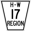
CR/RR 20 | |||||
|

|
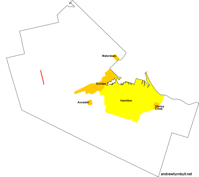
Westover Rd. | Safari Rd. north of Westover | ON 8, Peters Corners | 8 |
|
Adjustments: CR 20 originally ended at Concession Road 6 West in Westover, resulting in a route length of 6 km. By 1969, the route was extended north to Safari Road (CR 1). Succeeded by: RR 520. |
|||||
CR/RR 21 | |||||
|
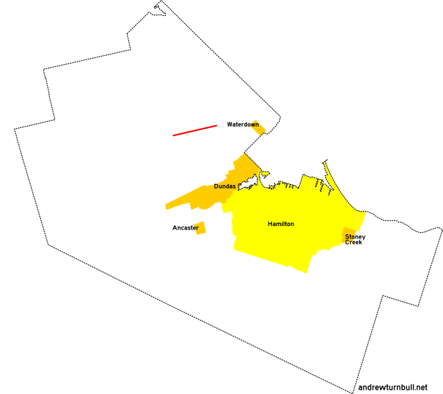
|
Millgrove Rd. | Westover Rd. south of Westover | ON 6, Millgrove | 11 |
|
Followed West Flamborough Concession Line 5. Adjustments: CR 21 originally terminated at Brock Road (CR 4) in Haysland, resulting in a route length of 5 km. Lengthened westward by 1977. Succeeded by: RR 521. |
|||||
CR/RR 22 | |||||
|
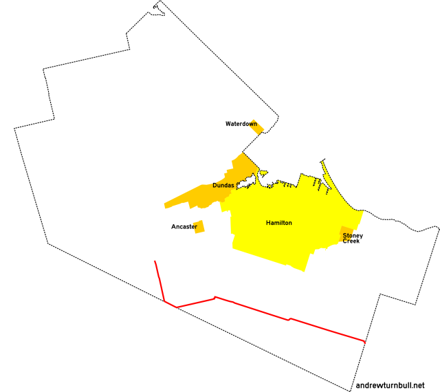
|
Trinity Rd. Sawmill Rd. Carluke Rd White Church Rd. Binbrook Rd. |
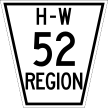
Wilson St. (ON 2/53) and ON 52 west of Duff's Corners | Niagara Region line east of Binbrook | 30 |
|
Followed Ancaster Concession Line 7, Glanford Concession Line 6, and Binbrook Concession Line 4, as well as a portion of the Wentworth-Brant county line. Adjustments: CR 7 originally terminated at Sawmill Road on the Brant County line, resulting in a route length of 24 km. By 1952 it was extended to meet in line with ON 52. Several jogs at township lines have also been straightened over the years. These changes are explained in more detail on the RR 65 page. Succeeded by: RR 222 (1979-2005), RR 622 (1979-2005), RR 65 (2005-present). This was the longest of Hamilton-Wentworth's county and regional roads from this era, and the only one that's still signed with a number today. |
|||||
CR/RR 23 | |||||
|

|
Lake Ave. Maple Ave. |
Historic Hamilton city limits, Hamilton Beach | QEW (no access), Hamilton | 2 |
| QEW (no access), Hamilton | Mountain Ave. S., Stoney Creek Village | 4 | |||
|
CR 23 followed the course of Stoney Creek's namesake stream upon a parallel road that had once formed an alternate route for Highway 8 in the 1920s. The north extremity of the road was bisected by the QEW by 1940, forming a discontinuity. By 1960 over half the route had been consumed by Hamilton city limits, leaving the CR 23 designation reduced to a 2 km stub in Stoney Creek. Previously: ON 8A, ON 20 (north segment). Succeeded by: Unnumbered road. The number was subsequently reused. |
|||||

|
|
Jerseyville Rd. | ON 52 south of Copetown | Wilson St. (ON 2), Ancaster Village | 5 |
|
By 1973, the CR 23 designation had been recycled and applied to a different road following Ancaster Concession Line 3. Succeeded by: RR 223. |
|||||
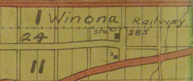
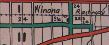
CR/RR 24 | |||||
|

|
Barton St. Melvin Ave. |
Hamilton historic city limits, Strathearne Ave. | ON 8 east of Winona | 14 |
|
Followed Saltfleet Concession Line 2. In its original configuration, CR 24 deviated south along what is now Melvin Avenue for a short distance immediately west of Red Hill Creek. By 1960, the portion of the road west of Grays Road had become subsumed by Hamilton city limits. Adjustments: The east extent of CR/RR 24 appears to have changed several times. 1940 maps show CR 24 turning at Winona Road and ending at ON 8, with an unlabelled spur providing access to a train depot. By 1952 (1960 map), the terminus turn had been moved east to Fifty Road...but the Winona Road forks remained as a concurrent part of CR 24. This came to an end by 1967, and later maps showed CR/RR 24 ending at Fifty Road just shy of Highway 8. |
|||||
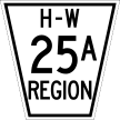
CR/RR 25 | |||||

|
|
New Mountain Rd. Ridge Rd. Tapleytown Rd. |
King St., Stoney Creek Village | (1940) ON 20 south of Tapleytown | 8 |
|
New Mountain Rd. Ridge Rd. |
King St., Stoney Creek Village | (1969) Niagara Region line east of Vinemount | 10 | ||
|
Adjustments: This road originally had an L-shaped routing. By 1969, CR 25 was taken off of Tapleytown Road and moved to what had previously been CR 25A, running parallel to ON 8 atop the escarpment. The former route became an extension of CR 34. |
|||||
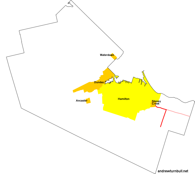
| (Shown above in red.) | Ridge Rd. | Tapleytown Rd. east of Stoney Creek Village | Lincoln County/Niagara Region line east of Vinemount | 7 |
|
Added by 1952; unnumbered before. Followed Saltfleet Concession Line 4. Incorporated into the CR 25 parent route by 1969. |
|||||
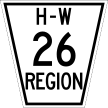
CR/RR 26 | |||||
|

|
Miles Rd. | Hamilton city limits west of Hannon | Dickenson Rd. | 2 |
|
Added by 1973; unnumbered before. Succeeded by: RR 626. |
|||||
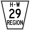
CR/RR 29 | |||||
|

|
Dickenson Rd. | ON 6 north of Mount Hope | Nebo Rd. south of 3 | 5 |
|
Added by 1973; unnumbered before. Follows Glanford Twp. Concession Line 3. Adjustments: CR/RR 29 originally had its east terminus at Miles Road, resulting in a length of 3 km. The route was extended east to its final terminus by 1977. Succeeded by: RR 629. |
|||||
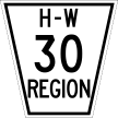
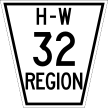
CR/RR 30 | |||||
|

|
Sanitorium Rd. Garth St. Fennell Ave W. |
(1940) Rice Ave. (approx.), Hamilton | 5th St. W., Hamilton | insignificant |
| (1952) Scenic Dr., Hamilton | Hamilton city limits at Rice Ave. | 4 | |||
|
CR 30 was one of Wentworth County's most bewildering numbered roads. 1940 maps show it as a multi-pronged assemblage of intersecting streets, clustered west of 5th Street on the Hamilton Mountain. By 1952, the west end of 30 had been extended through the Mountain Sanitorium grounds...and the rest had become subsumed within Hamilton city limits. By 1960, the west end had also been absorbed. The full extent of the bits and pieces of CR 30's routing was 5 km, though it's unknown if they were all officially part of the route at the same time. The number was subsequently reused. |
|||||
|

|
Ridge Rd. | ON 20 south of Stoney Creek Village | New Mountain Rd. east of Stoney Creek Village | 2 |
|
By 1973, the CR 30 designation had been recycled for a previously-unnumbered road connecting ON 20 to CR 25 atop the Niagara Escarpment. Succeeded by: RR 430. |
|||||
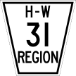
CR/RR 31 | |||||
|

|
Upper Paradise Rd. | Mohawk Rd., Hamilton | Rymal Rd. (ON 53), Hamilton | 3 |
|
By 1960, this road had become subsumed within Hamilton city limits. The number was subsequently reused. Succeeded by: RR 156. |
|||||
|

|
South St. | Old Ancaster Rd., Dundas | Osler Dr. (ON 8), Dundas | insignificant |
|
By 1973, the CR 31 designation had been recycled for a connecting street within Dundas' city limits. Succeeded by: RR 331. |
|||||
CR/RR 32 | |||||
|

|
Ogilvie St. Old Ancaster Rd. Old Dundas Rd. |
Governors Rd., Dundas | Wilson St. (ON 2), Ancaster Village | 5 |
|
Added by 1973; unnumbered before. The Old Ancaster-Dundas Road ran parallel to ON 2 and was part of that route's ancestor, bypassed by 1875(!). |
|||||
CR/RR 33 | |||||

|
|
Nebo Rd. Tyneside Rd. |
Rymal Rd. (ON 53), Hannon | Handimand County line, Tyneside | 10 |
|
Adjustments: CR/RR 33 originally terminated south of White Church Road, with a route length of 7 km. By 1952, it had been extended south to its ultimate terminus. Highway took a jog west at White Church Road via an invisible 600m concurrency with RR 622. By 1960, Hamilton city limits had encroached on its north end. |
|||||
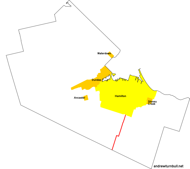
CR/RR 34 | |||||
|
|
Woodburn Rd. Hall Rd. Sinclairville Rd. |
(1940) ON 20 east of Elfrida | Short Rd., Sinclairville | 14 |
|
Tapleytown Rd. Woodburn Rd. Hall Rd. Sinclairville Rd. |
(1969) Ridge Rd. north of Tapleytown | Short Rd., Sinclairville | 19 | ||
|
Adjustments: By 1974, RR 34 was truncated south of Binbrook Road, leaving the extant part of the route with a 12 km length. |
|||||
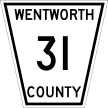
CR/RR 35 | |||||

|
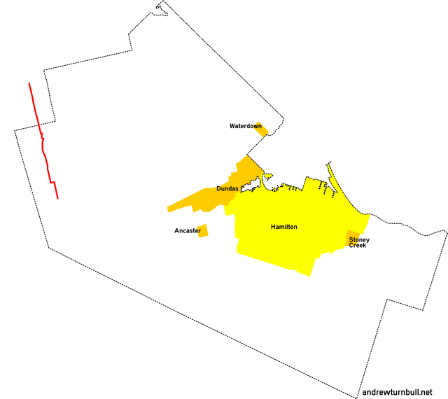
|
Village Rd. Sheffield Rd. |
Clyde Rd., Clyde | ON 5, Troy | 15 |
|
This was one of two numbered county roads that passed through an area ceded to the Region of Waterloo in 1973, resulting in a 6-kilometre truncation. Part of the ceded portion became North Dumfries Township Road 27A; however, it's not signed in the field. Adjustments: CR 35 originally terminated at ON 97, resulting in a route length of 13 km. By 1952 a small jog at the intersection with Concession Road 5 was smoothed out, and by 1960 the route had been extended to Clyde. The 1973 cessation resulted in the route being truncated to Safari Road (RR 1) in Sheffield, assuming a length of 8 km. Succeeded by: RR 535 (south of Safari Road) |
|||||
CR/RR 36 | |||||

|
|
Carlisle Rd. | ON 6 west of Carlisle | Halton Region line east of Carlisle | 6 |
|
Followed East Flamborough Concession Line 9. Succeeded by: RR 536. |
|||||
CR/RR 37 | |||||
|

|
Airport Rd. | Glancaster Rd. west of Mount Hope | ON 6, Mount Hope | 3 |
|
Added by 1952 as a stub road connecting ON 6 to Mount Hope's schools; unnumbered before. Extended by 1960. Followed Glanford Concession Line 5. Succeeded by: RR 637. |
|||||
CR 38 | |||||

|
|
Clyde Rd. | Waterloo County line west of Clyde | Village Rd., Clyde | 3 |
|
Added by 1952; unnumbered before. This was one of two numbered county roads that passed through an area ceded to the Region of Waterloo in 1973, and the only one completely within the ceded area. It followed Beverly Concession Line 10, and had no direct connection to other Wentworth County numbered roads until CR 35's designation was extended to Clyde circa 1960. Succeeded by: Waterloo RR 27 |
|||||
CR/RR 39 | |||||

|
|
Concession 2 Rd. W. | Lynden Rd., Lynden | ON 8, Christie's Corners | 10 |
|
Added by 1952; unnumbered before. Followed Beverly Concession Line 2. Took a very short jog along Middletown Road at the east end. Struck from the list of numbered roads by 1977. Succeeded by: Unnumbered road. |
|||||
CR/RR 40 | |||||
|
|
Fletcher Rd. | Rymal Rd. (ON 53) west of Elfrida | Kirk Rd. W. south of Binbrook | 8 |
|
Added by 1952; unnumbered before. Adjustments: CR/RR 40 originally terminated south of Binbrook Road, with a route length of 6 km. By 1977, it had been extended south to its ultimate terminus. Succeeded by: RR 640. |
|||||
CR/RR 41 | |||||
|
|
Howard Rd. Lemonville Rd. |
Plains Rd. W., Aldershot | Sumach Dr., Aldershot | insignificant |
|
Added by 1952 as a park access road in Aldershot. This route was one of two very short-lived (and very short) numbered roads contained entirely within an area of Wentworth County ceded to Burlington and Halton County in 1958. The number was subsequently reused. |
|||||
|
|
Main St. Cootes Dr. |
Main St. (ON 8), Dundas | Main St. (ON 8), Hamilton | 3 |
|
By 1973, the CR 41 designation had been recycled for ON 8's downloaded Cootes Drive bypass. Previously: ON 102 (1947-1964). Wentworth County maps continued to show the ON 102 designation through at least 1967. Succeeded by: RR 141, RR 341, RR 8 (still in commission today). |
|||||
CR/RR 42 | |||||
|

|
St. Matthews Ave. | Plains Rd. E., Aldershot | CN railway tracks, Aldershot | insignificant |
|
Added by 1952. This was one of two very short-lived (and very short) numbered roads contained entirely within an area of Wentworth County ceded to Burlington and Halton County in 1958. The number was subsequently reused. The road itself presently leads to the site of Aldershot's GO Transit station, and has also been severed in the middle. |
|||||
|

|
Evans Rd. | Parkside Dr. north of Waterdown | ON 5 north of Waterdown | insignificant |
|
By 1973, the CR 42 designation had been recycled for a short connecting road between Waterdown and Burlington, not too far away from the original CR 42's site on the map. Succeeded by: RR 542. |
|||||
CR/RR 43 | |||||
|

|
6th Concession Rd. | ON 6, Millgrove | CP Rail tracks and Millgrove Station, Flamboro Centre | 4 |
|
Added by 1952; unnumbered before. Adjustments: By 1967, the route had been truncated east of its intersection with Centre Rd. (CR 8). Succeeded by: RR 543 (west of Centre Rd). |
|||||
CR/RR 44 | |||||

|

|
York Rd. | ON 6, north of Dundas | Main St. (ON 8), Dundas | 7 |
|
Added by 1952; unnumbered before. Adjustments: By 1967 CR 44 had apparently been truncated from Main Street to King Street in Dundas (though some maps continued to show this portion of the route). By 1977, the south end of RR 44 was routed away from York Road onto the newly-constructed Olympic Drive. The prior alignment within Dundas became a second incarnation of RR 44A (below). |
|||||
| (Shown above in pink.) | Valley Rd. | York Rd., Dundas | Rock Chapel Rd. north of Dundas | insignificant |
|
The original incarnation of CR 44A ran along Valley Road. It was added by 1952, and struck from the list of numbered roads by 1973. Succeeded by: Unnumbered road. |
|||||
| (Shown above in red.) | York Rd. | Olympic Dr., Dundas | King St., Dundas | 2 |
|
By 1977, a new RR 44A was commissioned along a stub of York Road in Dundas bypassed by the main routing of RR 44. Succeeded by: RR 364. |
|||||
CR/RR 45 | |||||

|
|
Grays Rd. | QEW underpass (or Hamilton city limits) north of Stoney Creek Village | King St. near Stoney Creek Village | 3 |
|
Added by 1952. By 1960, Hamilton city limits had encroached on the north portion of the road. Succeeded by: RR 145, RR 445. Street name also given as Gray Rd; no consistency. |
|||||
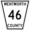
CR/RR 46 | |||||
|

|
Ogilvie St. | King St. W. (ON 8), Dundas | Governors Rd., Dundas | insignificant |
|
Formerly: ON 5B (1938-40) Concurrent with: ON 99. CR 46 is an anomaly; a sub-kilometre stub road running concurrently with ON 99 in Dundas. It may have been an internal designation referring to the portion of ON 99 under local maintenance. It appeared on maps from at least 1952 to 1963, by which point ON 99 had been moved off of CR 46 and onto CR 46A (below). Succeeded by: RR 330. |
|||||
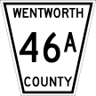
| (Shown above in pink.) | Governors Rd. | Ogilvie St., Dundas | Main St. (ON 8), Dundas | insignificant |
|
Concurrent with: ON 6. About 1959, the east end of ON 99 in downtown Dundas was moved off of Ogilvie Street and onto a newly-built block-long extension of Governors Road. This resulted in the previously-concurrent CR 46 briefly gaining a "46A" companion, reflecting its status as a connecting link under municipal maintenance. |
|||||
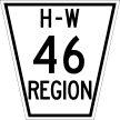
|

|
Gore Rd. | ON 52 on Wellington County line east of Clyde | Wellington CR 35 | insignificant |
|
By 1973, the CR 46 designation had been recycled and applied to a stub road connecting to ON 52's north end. Prior to then, Highway 52 terminated at the county line with no numbered connections! Succeeded by: RR 546. |
|||||
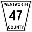
CR/RR 47 | |||||
|

|
Mountain Ave. S. Jones St. |
Maple Ave., Stoney Creek Village | King St. (ON 8), Stoney Creek Village | insignificant |
|
Verified as a numbered road from 1952 to 1967, then subsumed as a Stoney Creek village street. The number was subsequently reused. Succeeded by: Unnumbered road. |
|||||

|

|
Wilson St. | Hamilton Dr., Duffs Corners | Hamilton city limits south of Dundas | 7 |
|
Concurrent with: ON 2. By 1973, the "47" designation had been recycled and used as an internal designation for the portion of ON 2 in Ancaster covered by municipal maintenance. Although it was never signed this way in the field, it is labelled this way on 1973-77 county and regional maps. Succeeded by: ON 247. |
|||||
CR/RR 48 | |||||
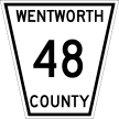
|

|
Upper Wentworth St. | Mohawk Rd. E., Hamilton | Rymal Rd. (ON 53), Hamilton | 3 |
|
Added by 1952. By 1960, this road had become subsumed within Hamilton city limits. The number was subsequently reused. Succeeded by: RR 167. |
|||||
|

|
McNiven Rd. Southcote Rd. |
Mohawk Rd. east of Ancaster Village | Garner Rd. (ON 53) north of Southcote | 3 |
|
Previously: RR 15A (northernmost 600m segment). By 1973, the CR 46 designation had been recycled and applied to an Ancaster connector road. The northernmost 600m segment was previously part of RR 15A. Succeeded by: RR 248. |
|||||
CR 49 | |||||
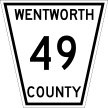
|

|
(unknown) | Waterfront Trail, Hamilton Beach | QEW interchange, Hamilton | insignificant |
|
CR 49 is a candidate for the shortest county or regional road that ever existed...in length and chronology. It was formed in the 1940s when a portion of ON 20 was moved onto a concurrency with the Queen Elizabeth Way; approximately 350 metres of the bypassed road became CR 49, while the balance became an extension of CR 23. By 1960, this connector had become subsumed within the Hamilton city limits. It now falls within Confederation Park, and is no longer open to through traffic. Previously: ON 8A, ON 20 (north segment). Succeeded by: Unnumbered road. |
|||||
CR/RR 50 | |||||
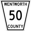
|

|
Pritchard Rd. | Mud St., Hamilton | Rymal Rd. (ON 53), Hamilton | 2 |
|
CR 50 was extremely short-lived as a numbered road, being added at some point after 1952, then absorbed into the Hamilton street grid by 1960. The 1960 map still shows the road's number, though it doesn't highlight its routing. The number was subsequently reused. |
|||||
|
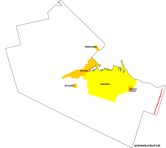
|
Fifty Rd. 11th Rd. E. |
QEW interchange near Winona | Niagara region line south of Tweedside | 9 |
|
By 1973, the CR 50 designation was recycled and applied to an expansion of CR 56, running from Winona south parallel to the Niagara Region line. Since one of the constituents of the route was Fifty Road (named after Fifty Mile Point on Lake Ontario), this is probably the only time that Wentworth County or Hamilton-Wentworth used a mnemonic for a highway number. Adjustments: By 1977, RR 50 was truncated south of Mud Street, resulting in a route length of 7 km. Succeeded by: RR 450. |
|||||
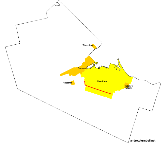
CR/RR 51 | |||||

|
|
Upper Horning Rd. Stone Church Rd. |
Mohawk Rd., Hamilton | Pritchard Rd., Hamilton | 11 |
|
Like CR 50, CR 51 was a short-lived numbered designation that came after 1952 and went away before a decade was even through. 1960 map view, showing the road enveloped by city limits. The number was subsequently reused. The Upper Horning portion of this route was bisected by the Lincoln M. Alexander Parkway in the 1990s, and is no longer drivable as a through road. The configuration of Stone Church Road has also been changed since the 1950s, removing its direct connection to Upper Horning Road. Succeeded by: RR 116. |
|||||
|

|
Freelton Rd. 11th Concession Rd. |
ON 6, Freelton | ON 6, Freelton | 2 |
|
Previously: ON 6. By 1973, the CR 51 designation had been recycled and applied to a section of ON 6 left behind by a bypass. Succeeded by: RR 551. |
|||||
CR/RR 52 | |||||
|

|
Homestead Dr. | ON 6, Mount Hope | ON 6, Mount Hope | 2 |
|
Previously: ON 5 (1925-27) and ON 6 (1927-5?). Section was left behind by a bypass before 1960. Succeeded by: RR 652. |
|||||
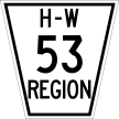
CR/RR 53 | |||||
|

|
Glancaster Rd. | Garner Rd. (ON 53) west of Ryckman's Corners | Carluke Rd. east of Carluke | 7 |
|
Added after 1952 and before 1960. Adjustments: This highway was made discontinuous in 1960 due to being bisected by the 12-30 runway of the Hamilton International Airport. Succeeded by: RR 253. |
|||||
CR/RR 54 | |||||

|
|
Hamilton St. | Parkside Dr., Waterdown | ON 5, Waterdown | insignificant |
|
Added by 1960; unnumbered before. This road was newly-constructed, and effectively replaced the segment of CR 8 it ran parallel to. Succeeded by: RR 554. |
|||||
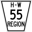
CR/RR 55 | |||||
|

|
Fruitland Rd. | QEW interchange near Fruitland | ON 8 near Fruitland | 3 |
|
Added by 1967; unnumbered before. The advent of CR 55 coincided with the construction of an interchange connecting it directly to the QEW. Succeeded by: RR 455. |
|||||
CR 56 | |||||
|

|
Fifty Rd. | QEW interchange near Winona | ON 8 east of Winona | insignificant |
|
Previously: A very short segment abutting ON 8 was once part of RR 24. CR 56 appeared by 1967. It was Hamilton-Wentworth's highest sequentially-numbered county or regional road...but its designation was short-lived. By 1973, the road was lengthened south to a new terminus north of Fulton in the Niagara Region...and it was renamed CR 50 in deference to Fifty Road and the nearby Fifty Mile Point on Lake Ontario. |
|||||
![[Home]](home.gif) The Network
The Network![[Back]](back.gif) Hamilton
Hamilton![[Forward]](forward.gif) 100 series
100 series